
MARCEL ET LES BLONDES
Personalised mountain bike poster — your ride, its gradients, its climbing
You started a design here. It is saved on this device.
MTB ride
The Estaing Loop
20 September 2026Cian Walsh
- under 3%43%
- 3 to 7%17%
- 7 to 12%26%
- over 12%14%
- Distance
- 40 km
- Climbing
- 1,202 m
- Descent
- 1,200 m
- Max altitude
- 722 m
- Time
- 4:04:05
- Avg speed
- 10.0 km/h
For all the muddy Sundays
The track is drawn exactly where it happened; drag the map to frame it, zoom with the buttons. The preview is what will be printed.
© OpenStreetMap contributors, data under the ODbL licence.
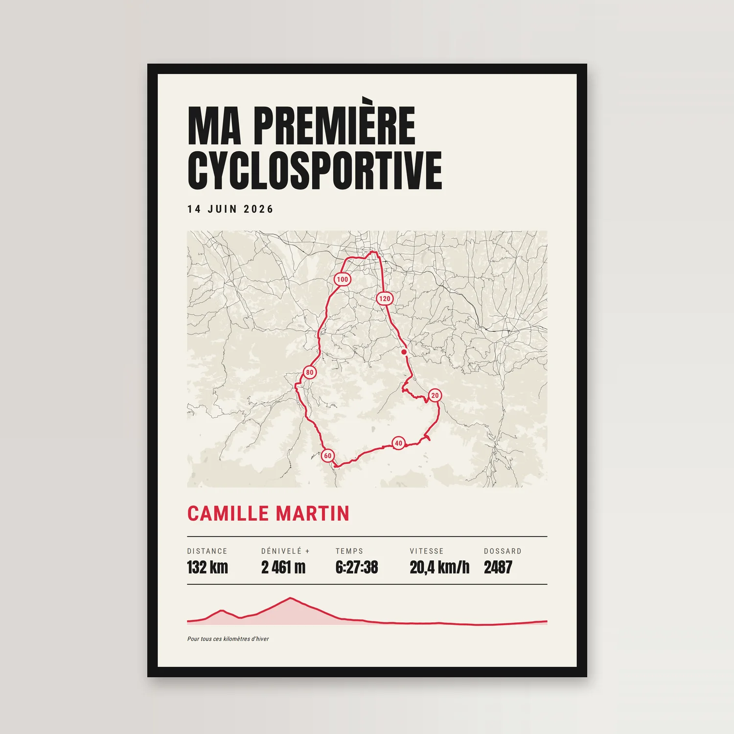
A poster of a mountain biker’s ride: the name of the ride in big letters, the date, the GPS route on the map coloured by gradient, then the elevation profile in the same colours with its highest point, and the distance, climbing, descent, maximum altitude, time and average speed. Route uploaded as a GPX file or imported from Strava. Six styles, 250 g matte paper, A4 to 70 × 100 cm.
Step 4 of 4: Create my map track · style · text
or

Pick an activity from your account: only its track goes with your order, and we disconnect from Strava as soon as it is imported.

Your personalisation
Check the spelling: the poster is printed exactly as is, to order.
-
Printed in AveyronComposed and printed in our family workshop in Aveyron, checked before it ships.
-
Printed to order250 g matte paper, pigment inks: printed in our Aveyron workshop, whatever the size.
-
Shipped within 48 hTo your door or to a pickup point, by La Poste or Colissimo.
-
Ready to giveStandard frame sizes, easy to find.
Secure payment
Full description
Your mountain bike ride on a poster: the name of the ride in big letters, the date, your route on the map, coloured by gradient from the green of the flat to the black of the steepest pitches, like trail markers, then the elevation profile in the same colours with its highest point, and your figures: distance, climbing and descent, maximum altitude, time and average speed.
The route comes from your bike computer or app: upload the GPX file, or connect your Strava account and pick the ride. The colours and the ride’s figures are not typed in: they are measured from the altitudes in the file. The time is the only figure you write, as h:mm:ss, and your average speed follows from it.
- 250 g/m² matte paper, pigment inks, printed to order.
- Five sizes: A4, 30 × 40, 40 × 60, 50 × 70 and 70 × 100 cm.
- Optional wooden frame on the A4 and 30 × 40, black, white or natural.
- Or the print-ready file: all five sizes, each as PDF and 300 dpi PNG, by download link.
The poster, once printed


Sizes
A4 · 21 × 29.7 cm
The keepsake: a birth, the sky of one date. Everyone owns an A4 frame, and it ships flat, in a stiff card envelope.
30 × 40 cm Our favourite
The entry size, the most common frame size: IKEA, HEMA, Action.
40 × 60 cm
Bedroom and hallway décor, in 2:3 like a photograph. 40 × 60 frames at homeware or framing shops.
50 × 70 cm
The flagship living-room size, sold across the market. Shipped rolled, in a sturdy long cardboard box, home delivery only.
70 × 100 cm
The large wall size. 70 × 100 frames at IKEA (RÖDALM). Home delivery only.
Prefer to print it yourself? All five sizes, each as a PDF and as a 300 dpi PNG — ten files, by a download link sent after payment.
How it works
- Bring your track
A GPX file from your watch or app, from which distance, time and elevation gain are computed, or a route from our library, with its distance.
- Frame it, pick a style and your text
The track on the map, exactly where it happened. Nine styles, a title, a subtitle, a dedication, the line of figures. Always portrait: what you see is what gets printed.
- We print in Aveyron
To order, on 250 g matte paper: in our Aveyron workshop, whatever the size, and every poster is checked there before it ships. Or you receive the download link for the file by e-mail.
Specifications
| Formats | A4, 30 × 40, 40 × 60, 50 × 70 and 70 × 100 cm |
|---|---|
| Paper | Matte, 250 g/m² |
| Inks | Pigment-based, lightfast |
| Optional frame | On A4 and 30 × 40: wood, black · white · natural, with acrylic glass |
| File only | All five sizes as PDF and 300 dpi PNG, by download link |
| Map data | OpenStreetMap |
| Design | Dandymaps® |
| Personalisation | Title · Subtitle · Rider · Time · Dedication · Style |
| Occasions | After a memorable MTB ride · A big mountain bike loop completed · A mountain range finally ridden · Birthday · Father’s Day · Christmas |
| Gift for | A mountain biker · A female mountain biker · A keen MTB rider · A riding buddy |
More gift ideas: A cyclist
For the same occasion

Frequently asked questions
Where does the route come from?
From your ride, as your bike computer recorded it: upload the GPX file of the ride (exported from Garmin Connect, Komoot, Strava, Polar Flow, your device’s website…) or connect your Strava account and pick the ride. There is no library of mountain bike routes: a ride is yours, and yours is the one we print.
What do the colours of the route mean?
The colour is the average gradient of each stretch, worked out from the elevation in your file: green under 3%, blue from 3 to 7%, red from 7 to 12%, black above 12% (on dark backgrounds the colours are lighter and black becomes cream, since black would not show). It tells you how steep, not which way: a 15% descent and a 15% climb are both black. It is averaged over stretches of about 250 m on a 40 km ride (a 160th of the distance), so a short ramp or a technical section is smoothed out. It is not a trail grade, which only someone who knows the trail can judge. The elevation profile takes the same colours, and the key shows how much of the ride falls in each band.
Which figures are printed, and where do they come from?
All of them come from your file: the distance, rounded to the kilometre (one decimal under 20 km); the climbing, meaning the elevation gain worked out from its altitudes; the descent, which is the climbing minus the difference in altitude between finish and start (on a loop the two roughly match); and the maximum altitude, the highest point of the smoothed profile. With Strava, the distance and the climbing are the figures Strava shows you. Two devices will not record the same elevation gain (barometer or GPS): the figure in your file is the one printed.
Which time and speed are printed?
The time you write, as h:mm:ss, always with the hours: 4:04:05, not 4:04. When the field is empty, the editor fills it with the elapsed time from the GPX file (if it has timestamps) or from Strava, and you can correct it. Average speed is the distance of the route, unrounded, divided by that time. Elapsed time includes stops, so the speed is then lower than the figure on your bike computer, which usually leaves the stops out — write your riding time if you prefer that speed. It is recalculated as you type. With no time, the box disappears: nothing is made up.
What do you do with my GPX file or my Strava account?
The GPX file is read in your browser and is never sent to our servers. With Strava, we read the list of your activities and the route of the one you choose, then hand the authorisation back to Strava as soon as the route is imported. In both cases the order carries only your texts and choices, the simplified route, the elevation profile and the figures.
Can I write the name of my ride or my event?
Yes: it is a free-text field of up to forty characters, with the date underneath. You write the name of the ride, the area you rode or the event you took part in. We add no organiser’s logo and no event name of our own: the poster carries only what you put on it.
Can I give it as a gift if I’m not the rider?
Yes, as long as you have their route: ask them for the GPX file of their ride (on the Strava website on a computer: the GPX export option of the activity) and upload it in the editor. You can add their name in seconds; the time is optional. Without a route, the poster would carry the example route.
Which sizes and frames?
A4, 30 × 40, 40 × 60, 50 × 70 and 70 × 100 cm: standard frame sizes, easy to find. Optional wooden frame on the A4 and 30 × 40, black, white or natural, with acrylic glazing; the large sizes are delivered rolled, to be framed at home.
What paper is the poster printed on?
Satin matte paper, 250 g/m², lightfast pigment inks. Printed to order in our workshop in Aveyron, whatever the size. Shipped rolled, in a long rigid cardboard box; the A4 goes flat, in a card mailer, and a framed poster in a carton.
Can I get the file instead of the poster?
Yes. The print-ready file contains all five sizes, each as a PDF and as a 300 dpi PNG — ten files in all, delivered by a download link sent after payment, to print wherever you like.
How long does it take?
Printed within 48 hours, then delivered to your home or a pickup point — home delivery only for the 50 × 70 and 70 × 100. Allow a week in France and ten days in the rest of the European Union. The download link for the print-ready file is sent the same day.